Censuses and Maps
PNN Corales del Rosario and San Bernardo
A series of maps and censuses prepared in the geographic context of the “Corales del Rosario and San Bernardo” National Natural Park (located on the Caribbean Sea coast of Colombia) with the objective of to face different prior consultations for collective titling or interventions of the Government of Colombia in the communities settled in this territory and covered under Law 70 of 1993.
Park Management Plan: Impacts and Measures
Gathering of geographic information in the field on various activities carried out by the communities settled in the territory, as inputs to draft the Impacts and Measures of the Natural Park Management Plan in consensus with the National Government. The data and sources of information were collected during a water tour throughout the park. The points or fishing grounds stand out, with the species and fishing practices used.
Applications and uses
Negotiation of the Community Use Zone, specifically the expansion of artisanal and subsistence fishing points.
Isla Grande
Community Self Census – 2019 & 2021
Georeferenced census capturing data through smartphones, carried out by members of the ancestral Orika community, based on the Isla Grande in the northern area of the PNN Corales del Rosario. Each registration form or form, upon completion, was automatically sent to a server on the Internet. The data is immediately available to be downloaded by different data analysis programs. In this way, enabling detailed geographical monitoring of the progress of the project and the productivity of each of the interviewers. The data was processed with thelibrary Python Pandas and is published for free access on GitHub (2019 & 2021).
This product was contracted within the framework of a project with the United Nations Migration Office – IOM.
Applications and uses
Humanitarian aid during confinement by Covid-19: the georeferenced census helped to quantify the amounts of aid required and its logistical distribution by sectors of the island and families.It served as the basis for defining a project to implement a desalination plant, in order to provide a regular drinking water system on the Island. It served as the basis for defining a project to implement a desalination plant, in order to provide a regular drinking water system on the Island.
Tourism Map
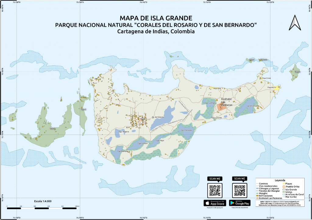
Printed map to distribute among the hotels on the Big Island in order to explain the geography to tourists, beaches, points of interest, swamps, channels between mangroves and coral reef. The map can be downloaded by scanning the QR code to support the journey to the interior of the island, populated by roads without demarcation and surrounded by the biodiversity of the Tropical Dry Forest.
It can be downloaded here.
Playa Blanca
Business Inventory 2018
Fieldwork with the community to identify all the businesses that exist along the beach, within the framework of the collective territory they claim. Categorizing their typology and if they belong to natives or foreigners.
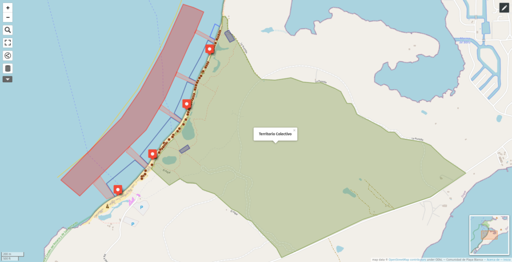
Collective territory – Prior consultation 2019
Survey of the polygon of the claimed collective territory to start the collective titling process.
Historic Center of Cartagena
State of properties 2017
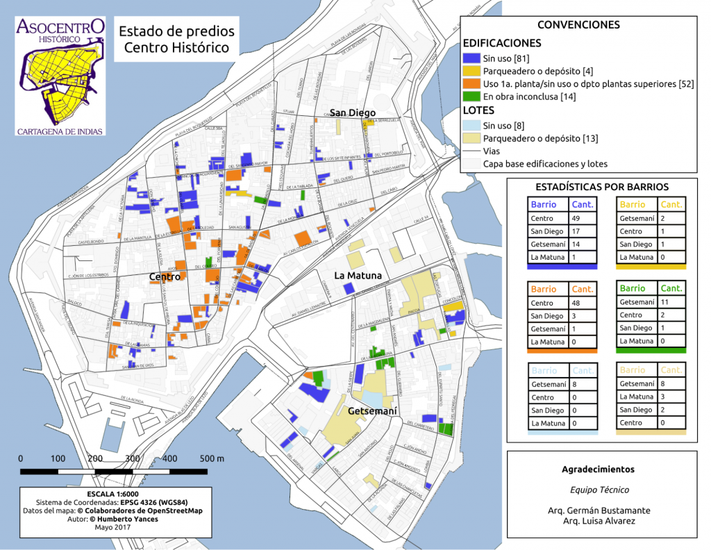
Effects on platforms, roads and drains 2018
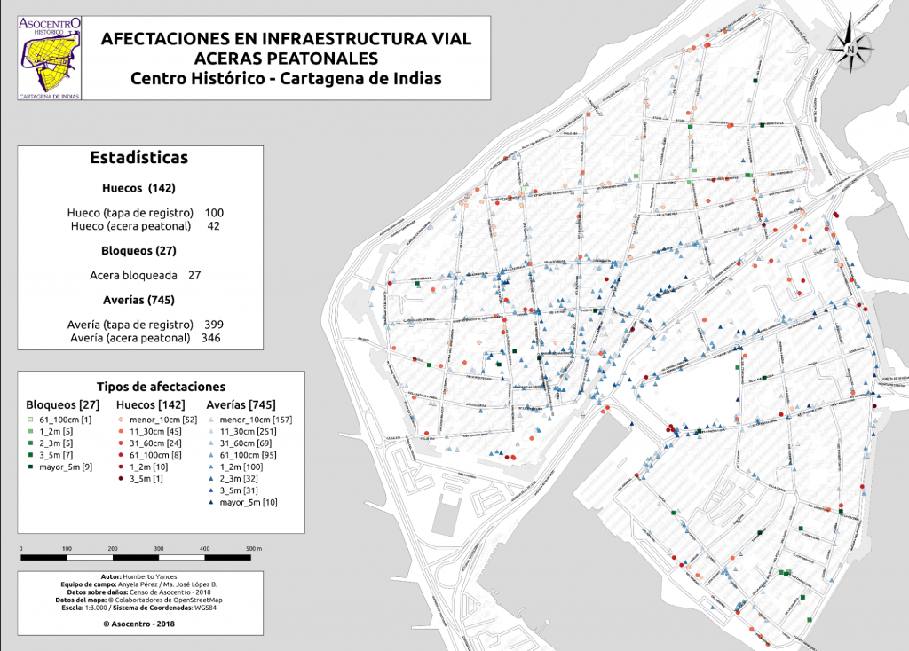
2018 State of road infrastructure and surface rainwater system of the Historic Center of Cartagena. http://bit.ly/danoscentro
Conferences and workshops
2016
World Bank / OpenDRI / JICA consultant for the National Risk Management Unit, mapping workshop using OpenStreetMap. Workshop: Training for flood mapping in Colombia. Bogota Colombia, 2016, October 26 – 28 :, https://opendri.org/opendri-partners-with-jica-on-training-for-flood-mapping-in-colombia/
Volunteers
2016 Project Coordinator: Activation of HOT – Ecuador Earthquake.
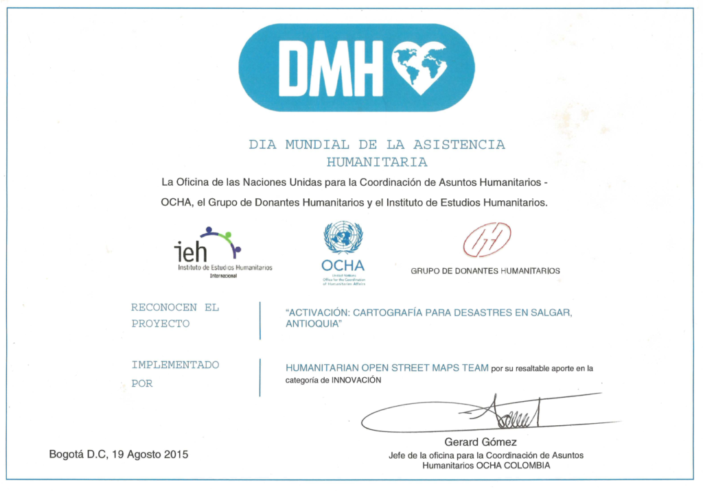
Awards
2015 Honorable Mention World Humanitarian Day: for coordinating the humanitarian mapping project in the landslides in Salgar, Antioquia. UNOCHA – Institute for Humanitarian Studies (IEH). Bogotá, Colombia, August 19, 2015. Project Coordinator Mapping Landslides in Salgar, Antioquia, Colombia.